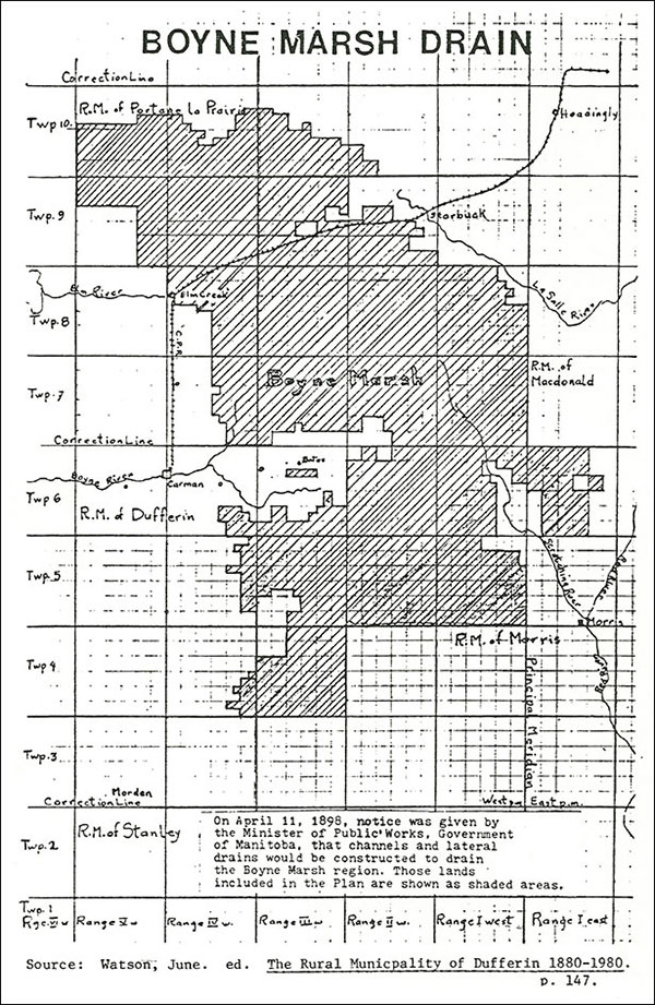
One of the prominent geographic features of the pre-settlement era was the Great Marsh (later known as the Boyne Marsh). It covered much of the land between the Missouri Trail and the Red River. The Rivière aux Îlets-de-Bois (Boyne River) and a network of creeks drained into the Marsh, resulting in flooding in Spring and providing hay and pastureland in drier times.
Because of the push to homestead the land and develop agriculture, some drainage was undertaken between 1880 and 1889 but without major results. In 1895, the Liberal government passed a Land Drainage Act and carried out a topological survey of the area. The survey revealed the extent of the drainage problem which in effect involved run-off from the Pembina Mountain watershed. An ambitious plan was put forward in 1898 to drain the Marsh, including some 40,000 acres in what was then the RM of Dufferin. The intent was to drain the Boyne River and Tobacco Creek run-off into the Morris and Red Rivers and to divert the Elm Creek overflow into the La Salle and Red Rivers. The plan was to pay for the project through land revenues and taxes that would result from the new farmland.
Newspapers from that time record the deficiencies of the drainage project which was routed through drier areas where dredging was easier but which did little to drain the Marsh. The newspapers also noted the vast amounts of wood and water required to run the steam engines. The Conservative Roblin government designed a new drainage plan which would connect the Boyne drainage to the Norquay Channel. Although still fraught with allegations of patronage, delays in building lateral drainage ditches and ongoing problems with flooding, the project was technically completed by 1907. Additional work continued till the 1920s. In later years, floods, by-pass channels, dams on the Boyne, and more recently, irrigation, have written new chapters in the story of man’s sometimes ill-conceived attempts to control Nature.

