The Rural Municipality of Dufferin lies in the rich agricultural region of South-Central Manitoba. The Town of Carman is centrally located and serves as the commercial hub for the area. It is here that the Dufferin Historical Museum and many of our local heritage resources are located.
When the Province of Manitoba was formed in 1870, waves of new settlers came in response to an opportunity to homestead the unbroken prairies. In the absence of roads, the accessible and fertile area near the Missouri Trail became a prime destination for the first homesteaders and for those who followed to provide services to the new communities.
The Rural Municipality of Dufferin is thought to have been named for Lord Dufferin, Governor-General of Canada. When it was first organized in 1880 the then municipality of North Dufferin extended south to Nelsonville near present-day Morden. After various attempts at restructuring, the present boundaries of the RM of Dufferin were established in 1908.
The first wave of settlers to the Rivière aux Îlets-de-Bois came primarily from Protestant Ontario. In response to the ensuing disagreement and tension over land ownership, many Catholic and Métis families abandoned the area. Evidence of their heritage lives on in the St. Daniel area. Historical accounts differ on exactly how and when the river became known as the Boyne. They agree, however, that the change marked the arrival and ascendancy of Protestant ‘Orangemen’ in the area. See also: The History of the R.M. of Dufferin in Manitoba 1890–1980, pp. 2-3; The Confrontation at Riviere aux Ilets de Bois; and the River Boyne.
Later, as the Boyne Marsh was drained, Mennonite settlers from Russia and post-WWII Dutch immigrants enriched the population mix and strengthened the agricultural base in the eastern part of Dufferin. Pockets of Francophone and Ukrainian settlement in the north-west, followed since the 1950s by an influx of Mennonite families from Southern Manitoba, have made similar changes in the western part of the municipality. More recent arrivals from around the globe have further enriched the multi-cultural heritage of the area.
Agriculture has remained the driving force in the local economy and is a key element of our heritage. From the early years on, Dufferin farmers were active in local agricultural societies and, fired by local politicians, such as R.P. Roblin, were vocal in pressing for land drainage, lower grain tariffs, rail lines, elevators and improved transportation.

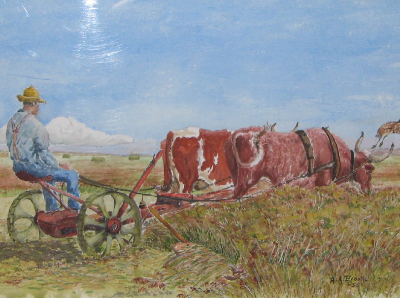
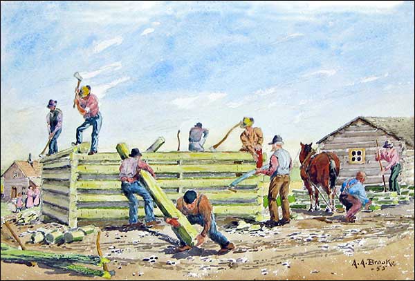
A.A. Brooke painted scenes of early Dufferin. His paintings are a feature attraction at the Dufferin Historical Museum.
The Carman/Dufferin area also is well known for its superb recreational and sporting facilities. Bounded on the west by the Pembina Hills, attractions in past included downhill skiing at Snow Valley and more recent interest in the area’s fine cross-country trails and in boating, fishing and camping at Stephenfield Provincial Park. The Town of Carman has a strong heritage in sport, notably in team sports such as baseball, hockey and curling; harness racing, or golfing at the excellent Carman Golf Club facilities.
Settlers Arrive
When the first permanent settlers arrived in the late 1800s, this area was covered in the east by the great Boyne Marsh. The Missouri Trail skirted the western edge of the wetlands. It was travelled by nomadic Indigenous Peoples, trappers, buffalo hunters and later, by early settlers to the area. Prairie grassland and densely wooded areas extended west to the escarpment that once formed the edge of Glacial Lake Agassiz.
In 1870, Manitoba became a province. This opened the floodgates to a wave of new settlers. As the land was taken up by homesteaders, the area was gradually transformed by cutting trees for building and fuel, breaking the prairie grasslands to plant cereal crops and draining the swamp. The latter project was undertaken by one of Dufferin’s most notable native sons, R.P. Roblin, premier of the province from 1900 to 1915. Further impetus for settlement and agricultural prosperity of the region came from the arrival of the railroads.

Settling the West. With the 150th anniversary of Manitoba just a year away, one of our objectives for 2019 is to better understand the impact that formation of the province had on local population density, ethnic and religious make-up, patterns of land ownership and land use.
Between 1670 and 1869, the Hudson Bay Company (HBC) held a charter and trade monopoly on all lands draining into Hudson Bay. Towards the end of this period, competition from American fur trading companies and the development of faster, cheaper southern transportation routes eroded the monopoly at the same time that HBC commercial interests were expanding beyond the fur trade. Finally, in 1869, the Company surrendered its charter back to the British Crown.
Meanwhile, in spite of the Canada-USA border treaty of 1818, the Canadian government had begun to fear that the westward surge south of the border would outflank their own efforts at settlement and that the USA would occupy and lay claim the western prairies. In 1870, the John A. Macdonald government paid £300,000 compensation to the HBC and their former holdings became part of Canada under the Constitution Act. One of the new government’s first undertakings was to survey the territory in preparation for opening it to settlement.
Surveying. Agricultural landholdings at that time were laid out mainly along the Red and Assiniboine rivers using the river lot system of survey. Narrow frontage along the river gave access to transportation and nearby neighbours, along with land for farm produce to the rear of the property. Under the new survey system, the land was divided instead into townships of thirty-six sections, each section approximately one mile square. Within each township, lands were set aside for the HBC, school lands and later, for railways. Grants also were made for military service or service with North West Mounted Police. Those, such as Métis settlers, who were already on the land, were given ‘scrip’ which could apply to purchase of the land or could be sold for cash. The rest of the land was open to homesteading.
Homestead Act. Under the Dominion Lands Act, 1872, or Homestead Act, a person over 21 could obtain a land grant by laying claim to a quarter-section land and paying a $10 administration fee. They were required to live on the land for at least six months a year for three years, build a dwelling and cultivate a specified number of acres of land. After meeting these requirements, they could apply for a patent, which gave them full title to the lands. Between 1872 and 1889, homesteaders could pre-empt or claim the right to buy, an adjoining quarter- section of land. This promise of land, fired by a strong dose of religious and cultural propaganda, unleashed a wave of westward migration that dramatically changed the socio-economic structure of the province.
For an overview of land settlement in the Boyne area, see A Review of the Heritage Resources of Boyne Planning District, by Karen Nicholson, pp 8–15.
Railways
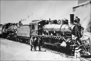
Rail lines were the lifelines of new settlements, connecting them with larger centres, bringing in mail and supplies and transporting grain and livestock to market. Communities lobbied and offered bonuses to competing rail companies. In 1882, the Manitoba Southwestern Colonization Railway (later the Canadian Pacific Railway) was built southwest from Winnipeg. Unfortunately, it stopped short of Carman at End-of-Line (Barnsley) until 1887 when the CPR extended the line the final six miles to Carman.

Population Centres
The Town of Carman (population around 3,000) is now the main commercial and retirement centre in the Carman/Dufferin region. A few hamlets—Homewood, Graysville, Stephenfield, and Roseisle—lie scattered in an east-west line across the RM of Dufferin, the last of a number of small, vibrant communities that once dotted the rural countryside.
Other early communities were bypassed by the rail lines and gradually disappeared. Such was the fate of several settlements in the RM of Dufferin such as Almasippi, Bates, Bradburn, Campbellville, Salterville, St. Daniel, Barnsley and Lintrathen. This is an important part of our heritage that now is evidenced only through cairns or signs erected over the years by the CD MHAC or local community; some are unmarked.
See also: Communities, Schools
